Well, not exactly. My plan after Burning Man was to head to the east coast where I have a project I am working on. A sailboat. Yes, a vehicle that travels very low and very slow. I moved aboard a few days ago and the plan was to head out into the Chesapeake Bay to enjoy the last warm days of Fall and get in some crabbing and fishing and lots of solitude. Also, I was planning to work on the blog.
Plans changed quickly. The first day I anchored way up in a creek off of the Little Choptank River on the Eastern Shore of Maryland. The forecast was for light southerly winds becoming northerly with the passage of a cold front the next day. That evening as I was laying at anchor and enjoying my crab dinner I listened to the NOAA weather radio and now the winds were supposed to be from the south and then southwest at 15 knots with gusts to 25. Luckily I was in an anchorage that was very protected from southerly winds but that night we had gusty winds, rain and thunder storms nonstop.
The next morning, which was yesterday, things were fairly calm but the crab bucket I left on deck overnight contained almost two inches of rain. The weather was now calling for horrible weather with strong northeast winds and rain for the next several days. Until perhaps hurricane Joaquin makes an appearance. Time to get moving, looks like now or never and the anchorage I was in was way too remote and exposed. I decided to head for Solomons Maryland on the western shore of the bay in Southern Maryland. It turned out to be a pretty nice day early on but I had to motor the entire way as the winds were still from the southeast. Right off my bow. I made it in about noon yesterday. I anchored off a marina, launched my dinghy and headed ashore. After talking to some locals I headed further up Back Creek to a well protected area to wait out the weather.
That was yesterday. Last night it was windy and rained all night. Today it has poured down rain all day. I am warm and snug in my cabin doing some writing. At least that is going as planned. I am writing to a file and hope to cut an paste this to my blog when I can get internet by going ashore. At the marina they told me that there is a dinghy dock near where I am now anchored and it is just a block from the library. So, hopefully I will be able to upload this along with some pictures tomorrow. Too much rain today. I will have to go out and bail my dinghy soon. I am not looking forward to it. Cold windy and rainy up there. Warm snug and secure down here. I have plenty of food, water and fuel. I could stay stay onboard for couple of weeks easily. There are plenty of boat projects to keep my busy.
Don’t worry, I’ll get to Burning Man. Eventually.
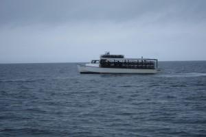
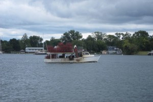
I took these two pictures on Wednesday when I was heading from the Little Choptank River to Solomons Marlyand. These are crabbers and what is telling is that they have pulled up all of their traps so they won’t lose them with the bad weather on the bay.
 You can see them stacked up in just about every available space. Usually they just pull them up, empty the crabs out (hopefully), rebait them and throw them back in. But, not today.
A month or so ago I installed a new VHF marine radio that has the ability to receive the position reports transmitted by AIS transponders that are required to be installed on large ships. I coupled it to the GPS that came with the boat and here are some pictures of the first time it gave me a collision alert. The magenta line is my planned course across the bay to Solomons. As you can see I have diverted to the left of course and the large red triangle is the ship “Alexandra”. The AIS receiver picked it up before I could see it and I diverted to the east of my planned course to avoid it. The GPS is still warning me a a possible collision. See the little sunken ship? 
This is what the Alexandra looked like just after the above picture was taken. Don’t want to collide with that.
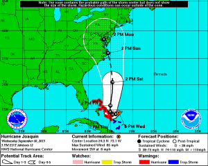
And finally, here is the track forecast for Joaquin he evening I anchored at Solomons. I am right where the black “S” symbol is located over the Chesapeake Bay at the end of the five day forecast track.

